
Weather Forecast
Increasing humidity and periodic showers Wednesday through Friday.
At a Glance

Tuesday Night
Clear to partly cloudy.
Mainly upper 50s to mid 60s
Wednesday
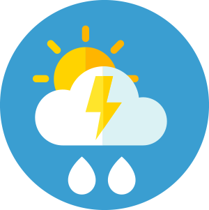
Scattered showers and storms, mainly after noon.
Upper 70s to mid 80s
Thursday
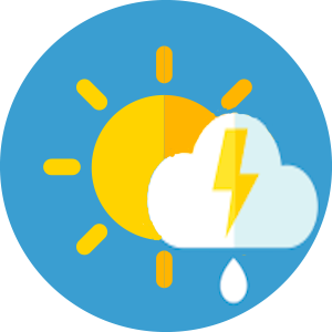
Widely scattered showers and storms.
Mainly mid 80s
Friday
Chance of showers and storms.
Mainly mid 80s to around 90
Eye on the Sky Forecast, June 10, 2026
Weather Forecast
Extended Forecast | Significant/Hazardous Weather | Recreational Forecast | Detailed Discussion | Farm & Garden | Wind by Elevation | Temperature by Elevation
Detailed Forecast
Tuesday Night:
Clear to partly cloudy. Chance of a late-night shower in the Adirondacks and St. Lawrence Valley. Patchy valley fog east of the Greens. Lows from the upper 50s to mid 60s, some mid 50s northeast. Winds becoming light and variable, except south 5 to 10 mph in the Champlain and St. Lawrence valleys.
Wednesday:
Patchy valley fog early east of the Greens. Otherwise partly to mostly cloudy, with showers and thunderstorms likely in the Adirondacks and St. Lawrence Valley; a rising chance elsewhere, mainly after noon west of the Greens, and mainly late in the day east of the Greens. Highs from the upper 70s to mid 80s. South winds 5 to 10 mph, gusting to 20 mph in the Champlain Valley.
Wednesday Night:
Scattered showers and thunderstorms early, decreasing overnight. Lows in the low to mid 60s, some upper 60s in the Champlain Valley. Winds becoming light and variable, except south 5 to 10 mph in the Champlain Valley.
Extended Forecast
Thursday:
Variable clouds. Widely scattered showers and thunderstorms, mainly in the afternoon. Highs in the low to mid 80s, mid to upper 80s in western and southeastern valleys. Winds light, variable to south.
Thursday Night:
Localized evening showers or a thunderstorm, diminishing overnight. Warm and humid. Lows in the 60s.
Friday:
Periods of sun and clouds. Chance of showers and thunderstorms, mainly north. Highs from the mid 80s to around 90, some lower 80s east of the Greens.
Friday Night:
Mostly cloudy. Showers and thunderstorms becoming likely. Lows in the upper 50s to low 60s.
Saturday:
Scattered morning showers, mostly east of the Greens. Increasing periods of sunshine west, spreading east. Highs in the upper 70s to lower 80s north, and in the 80s south.
Significant/Hazardous Weather
None.
Recreational Forecast
Mountain Forecast:
The summits bask in the sunshine for another day, along with freshening west winds, and temperatures several degrees warmer. For Wednesday, periods of clouds increasing and lowering toward the summits, with a rising chance of showers and thunderstorms. Moderate south to southwest winds, and temperatures quite warm and more humid. Thursday’s outlook calls for periods of clouds, a few breaks of sun, with localized showers or thunderstorms, especially in the afternoon. Light northerly winds, while temperatures climb several more degrees.
Wind At Lower Elevations:
Winds today light, mainly west and south less than 10 mph, with waves on the open waters of Lake Champlain 1 to 2 feet. Tonight, winds diminishing to light, becoming south near 10 mph in the Champlain and St. Lawrence valleys, with waves on the open waters of Lake Champlain near 1 foot. On Wednesday, winds light, becoming south near 10 mph, gusting to 25 mph through the Champlain Valley, with waves on the open waters of Lake Champlain 1 to 2 feet. The outlook for Thursday calls for light winds.
For more details on Lake Champlain, go to: https://forecast.weather.gov/product.php?site=BTV&product=REC&issuedby=BTV
Detailed Discussion
A well-behaved preview of summer yesterday, with low humidity, temperatures in the 70s to around 80, and gentle breezes, the result of high pressure leisurely strolling south across the region. This high kept skies clear last evening, perfect for viewing the conjunction of the planets Venus and Jupiter in the west-northwest, joined to their lower right by the elusive Mercury, best seen from 9:15 through 9:45. The clear skies and light winds helped thermometers cool to the 40s and low 50s again, however our fresh, comfortable start to the day will be the last one this week. This morning finds the high well to our south, east of Delaware in the western Atlantic, continuing to drift south and east, away from us. It takes the pleasant, comfortable air with it, as well as encouraging a warmer, and increasingly humid southwest airflow. That starts with a warmer afternoon today, lots of sunshine, and readings climbing to the low and mid 80s, just a few upper 70s across the higher terrain north. A few clouds begin to arrive tonight, with a stray shower possibly late in the St. Lawrence Valley into the Adirondacks, and a slight chance in the northern Champlain Valley. The clouds will gather tomorrow with the approach of a disturbance over the Ohio Valley and Great Lakes. This means any sun Wednesday morning will be limited, as we watch the clouds expand and grow taller, part of the process of showers developing, perhaps a thunderstorms or two in places, especially in the afternoon and evening. Temperatures should again reach the upper 70s and 80s, though it may feel warmer as it becomes rather muggy. That system and its showers should continue east Wednesday night, decreasing the showers, but leaving the very warm, very humid air in place. That invites a scattering of showers or thunderstorms Thursday and Friday, typically enhanced by the heating of the day, so the chances are greater in the afternoon and evenings. They will tend to be localized, which means some of us could get rather wet, while others remain on the dry side. Temperatures should remain warm and muggy through the time frame, mostly in the 60s at night, and 80s during the day. With enough sunshine, the warmer valleys, especially south, could nudge ninety degrees. A cold front pivots east around a storm over Hudson Bay Friday night, enhancing the showers and thunderstorms, tapering off Saturday as cooler and less humid weather attempts to return next weekend.
Farm & Garden
Rainfall Forecast:
No rain through tonight, except a stray shower late through the St. Lawrence and northern Champlain Valley, and northern Adirondacks. Showers increasing Wednesday through the day, decreasing Wednesday night. Rainfall covering 60 percent of the area, with localized amounts of 0.10 to 0.25 inches, locally over 0.50 inches. Additional scattered showers or thunderstorms Thursday and Friday, with light to possibly localized moderate amounts. A chance of showers Saturday, mainly in the morning east of the Green Mountains, with localize, generally light amounts.
Drying Conditions:
No rain today, with excellent drying conditions, and minimum relative humidities near 30 percent. Fair drying conditions Wednesday, with a good chance of showers, keeping minimum relative humidities near 65 percent, and several hours of wetting. Fair drying conditions Thursday and Friday, with a chance of showers each day, and minimum relative humidities near 60 percent. Drying conditions improving to good on Saturday, though a few showers before noon are possible east of the Green Mountains.
Frost:
No frost expected for at least several days.
Wind by Elevation
| Elevation | Today | Wednesday | Thursday |
| 2000ft | W 5 to 15 mph | S 10 to 15 mph | light/variable |
| 4000ft | W 10>15 mph | SW 10 to 20 mph | NW 10>W 5 mph |
| 6000ft | WNW 15>35 mph | W>SW 15 to 30 mph | NW 15 to 30 mph |
Temperature by Elevation
| Elevation | Today | Wednesday | Thursday |
| 2000ft | 77 N/84 S | 76 N/84 S | 81 N/85 S |
| 4000ft | 65 to 70 | near 70 | near 70 |
| 6000ft | 50s | 55 to 60 | 55 to 60 |
Weather Journal
June 10, 2026
Sunrise: 5:06 AM
Sunset: 8:33 PM
Length of day: 15 hours and 27 minutes
Two rounds of severe thunderstorms banged and crashed their way across Vermont on this date in 2008. Over 50 reports of damaging winds, and several reports of hail had untility companies scrambling to service 50,000 customers that lost power. Winds gusted to 80 mph, knocking down trees and power lines. Hail up to an inch in diameter pelted Shelburne and Williston, VT.
Current Conditions Maps – Quick Links


This program is a partnership between the Fairbanks Museum and Vermont Public.